Torres del Paine

IMG_6060

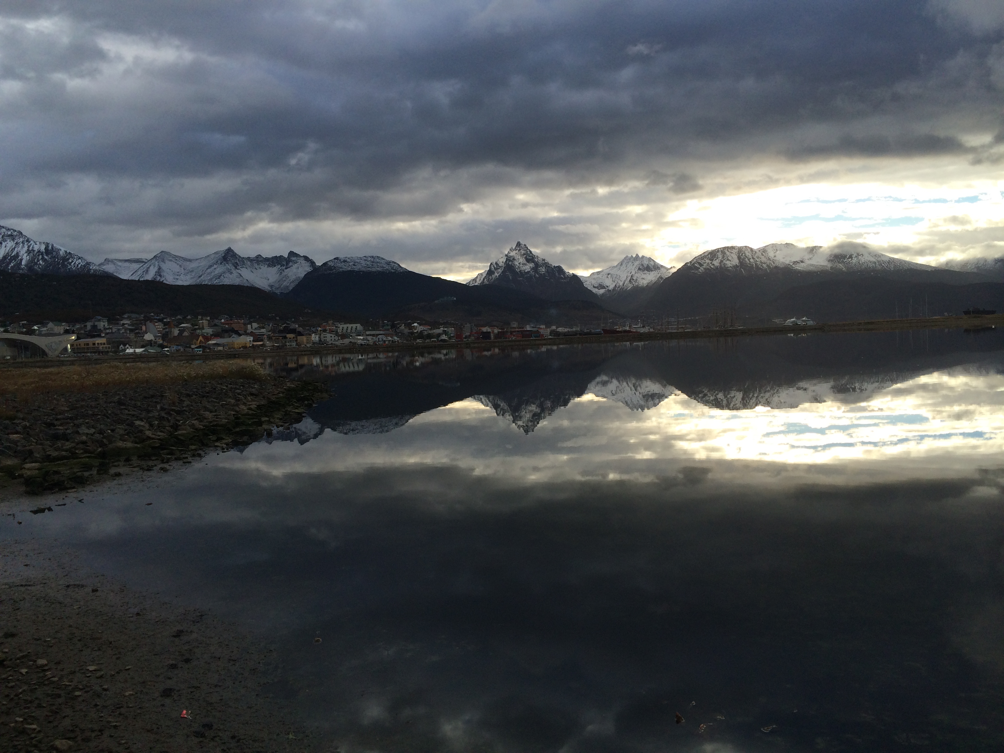
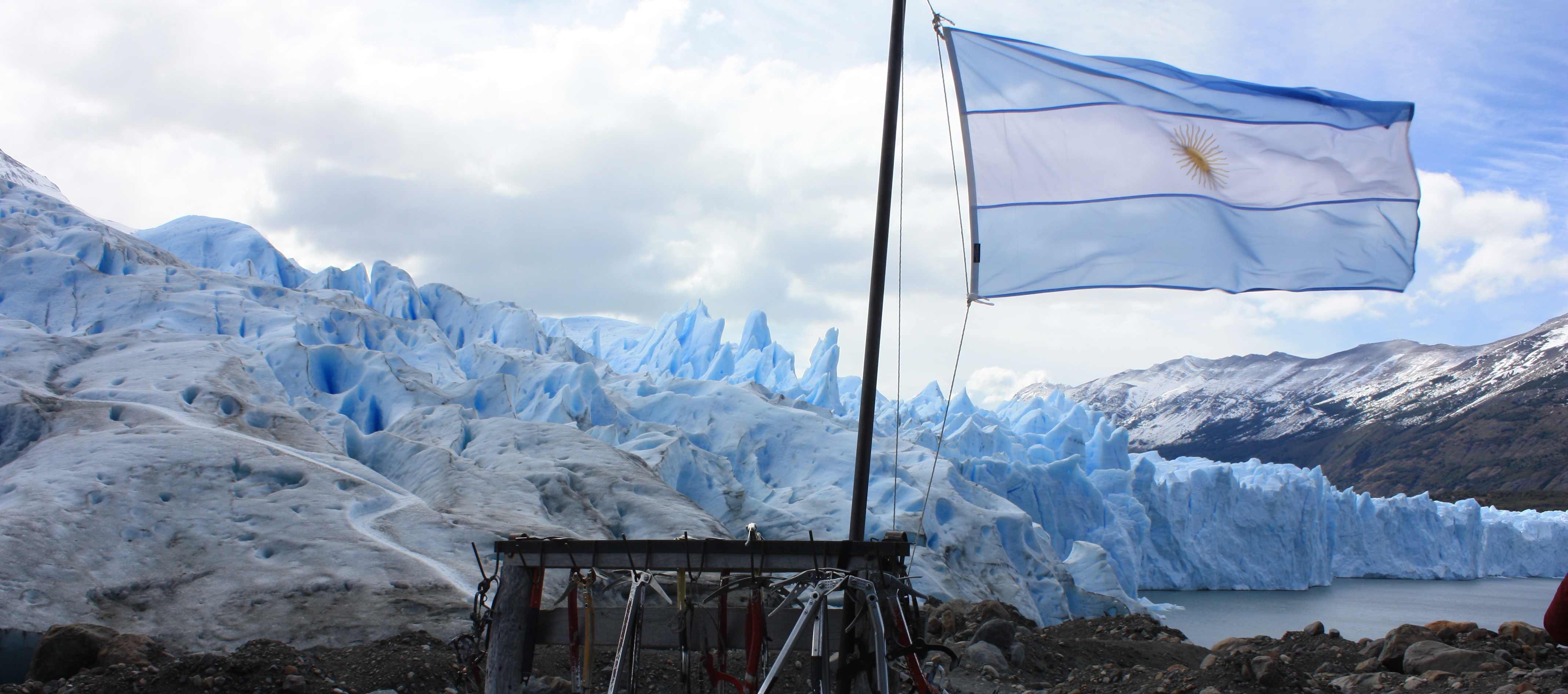
The W Trek (well, almost…)

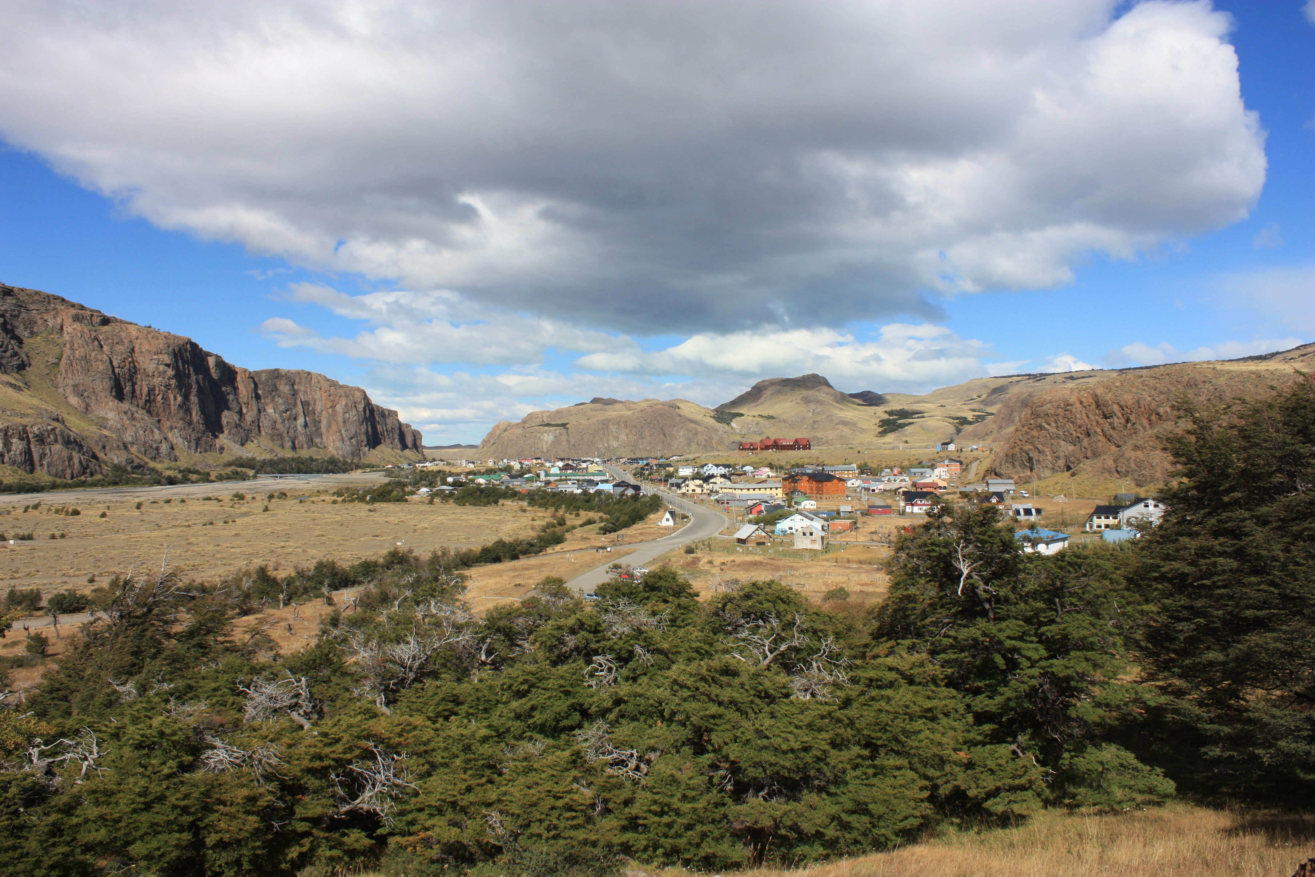
The Torres del Paine national park is one of the most well known parks in Patagonia. Situated close to the southern tip of Chile, on the edge of the Andes, it is a beautiful place with stunning granite peaks, lakes, glaciers and unpredictable extreme weather. There are two main trekking routes here,  the Circuit which is approximately a nine day loop around the Cordillera del Paine and then there is the more popular W trek, a four or five day trail in the shape of a W. The W trail can be done as a camping trek or it is possible to stay in refugios the whole way while the Circuit, at least while off the W route, is camping only. Access to the treks is via Puerto Natales which is easily accessible by air via Punta Arenas, bus from El Calafate and Ushuaia in Argentina or Ferry from Puerto Williams or Puerto Montt.

My original intention was to trek the full circuit but given I was in the shoulder season (March 2014) and the weather was particularly average I decided to only do a four day trek of the W.

Screen Shot 2014-05-29 at 1.29.51 pm

Day 1 – Puerto Natales to Paine Grande and Refugio Grey

IMG_4517The trip out to the Torres del Paine nations park started with a 7:30am two hour bus ride from the main bus terminal on Puerto Natales. The first stop is the ranger station at Laguna Amarga to pay the park fee, get the park map and agree to the rules of the park. You can then either begin the W trail there (this is also the place most people begin the Circuit) or jump back on the bus and continue on. The next stop is Cafeteria Pudeto where a catamaran powers across Lago Pehoe to Refugio y Campamento Paine Grande which is another popular starting point for the W trail and is where we started.

It is a half hour boat ride across the lake which gets you to Paine Grande at around 12:30pm. Given we were looking to complete the trail in four days we had a bit of a tight schedule today so we quickly set up camp, partially sheltered from the strong winds at the base of a small hill, and then headed off to Refugio Grey. The weather was a bit patchy but at times we saw the sun and some blue skies, the wind however was relentless and incredibly strong, at times the gust were enough to push you over if you didn’t have solid footing.

IMG_4554
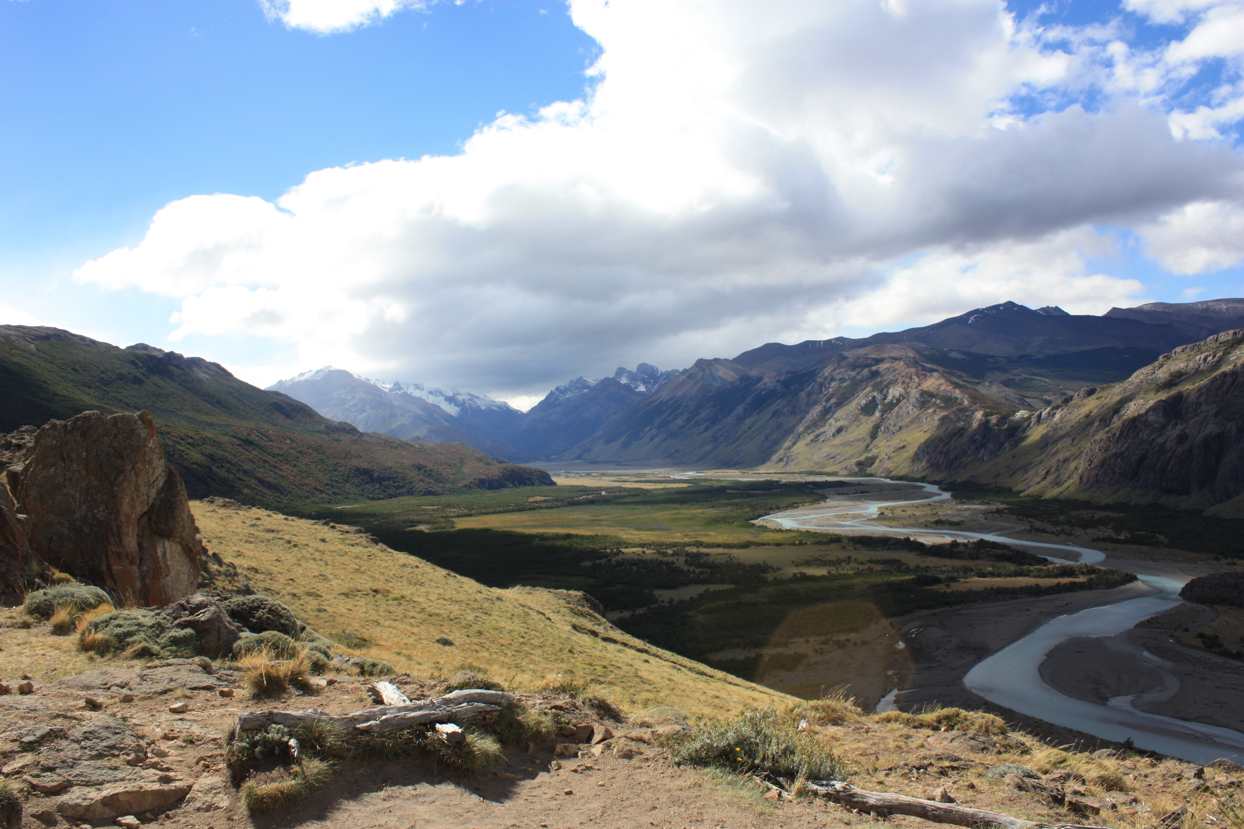
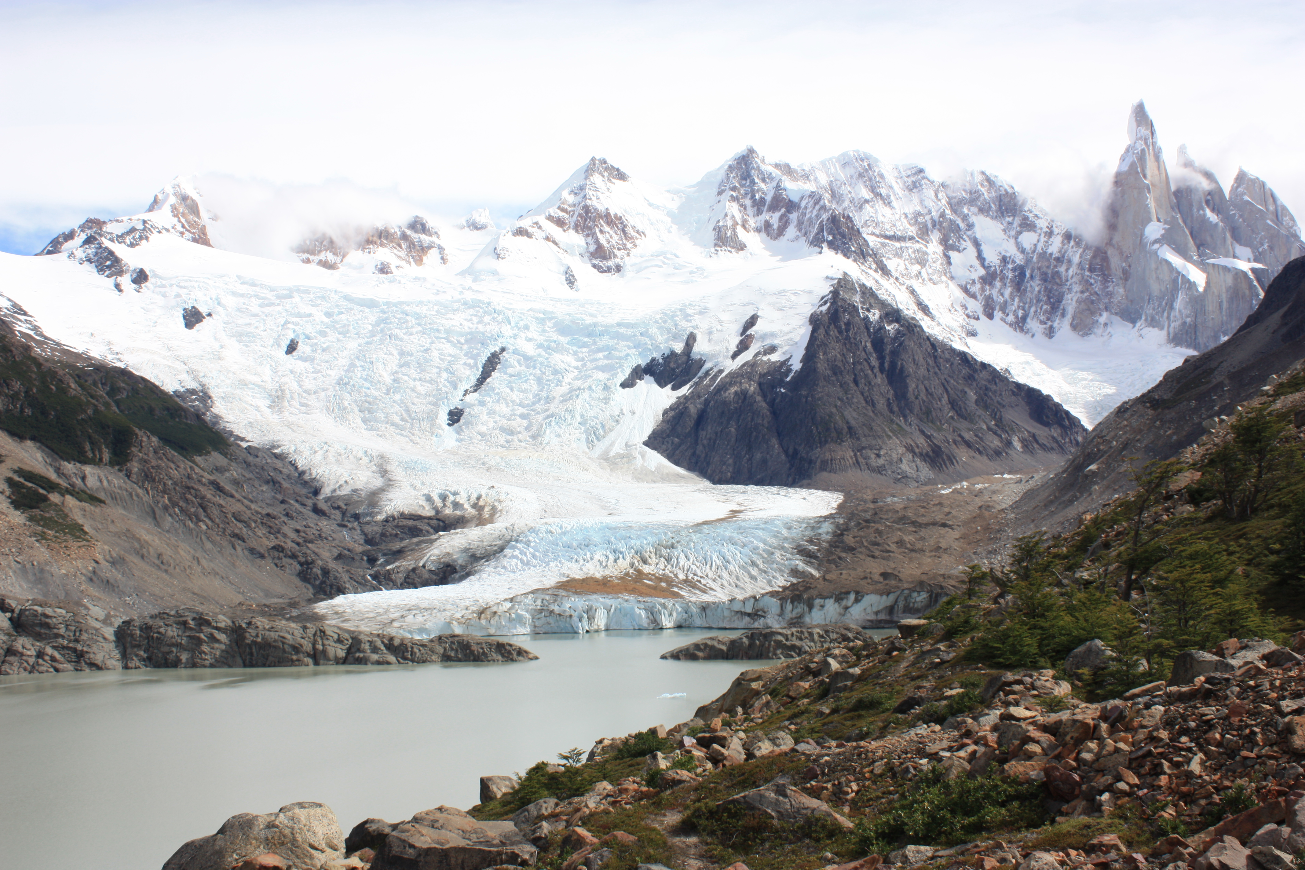
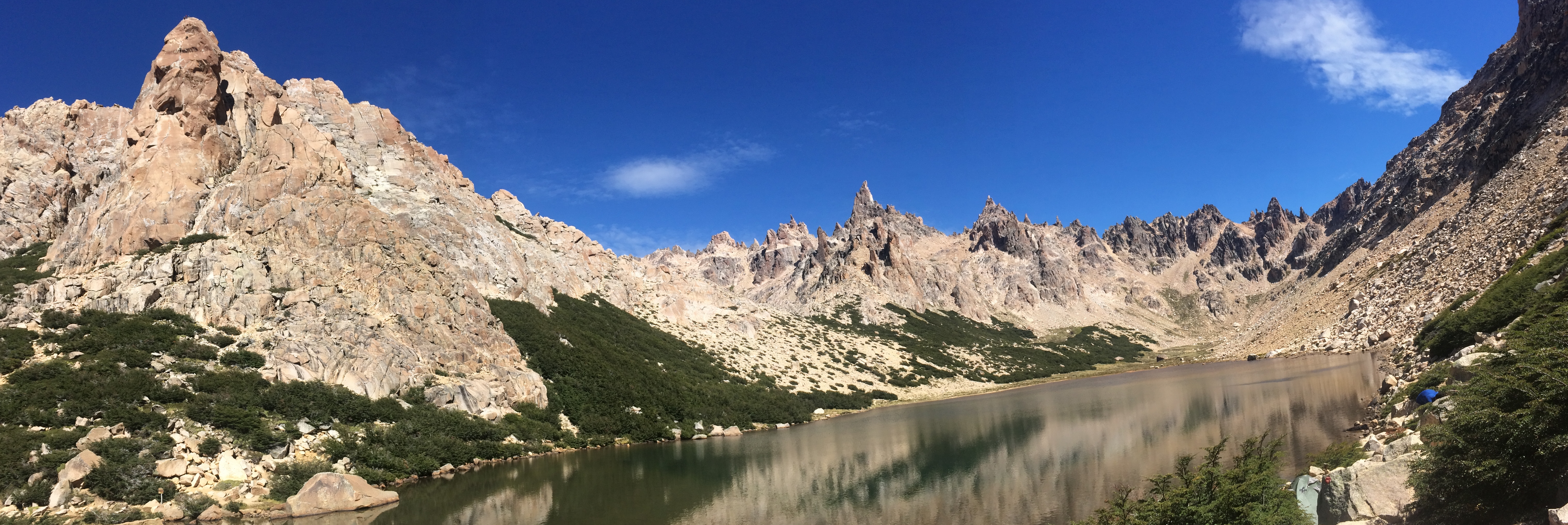
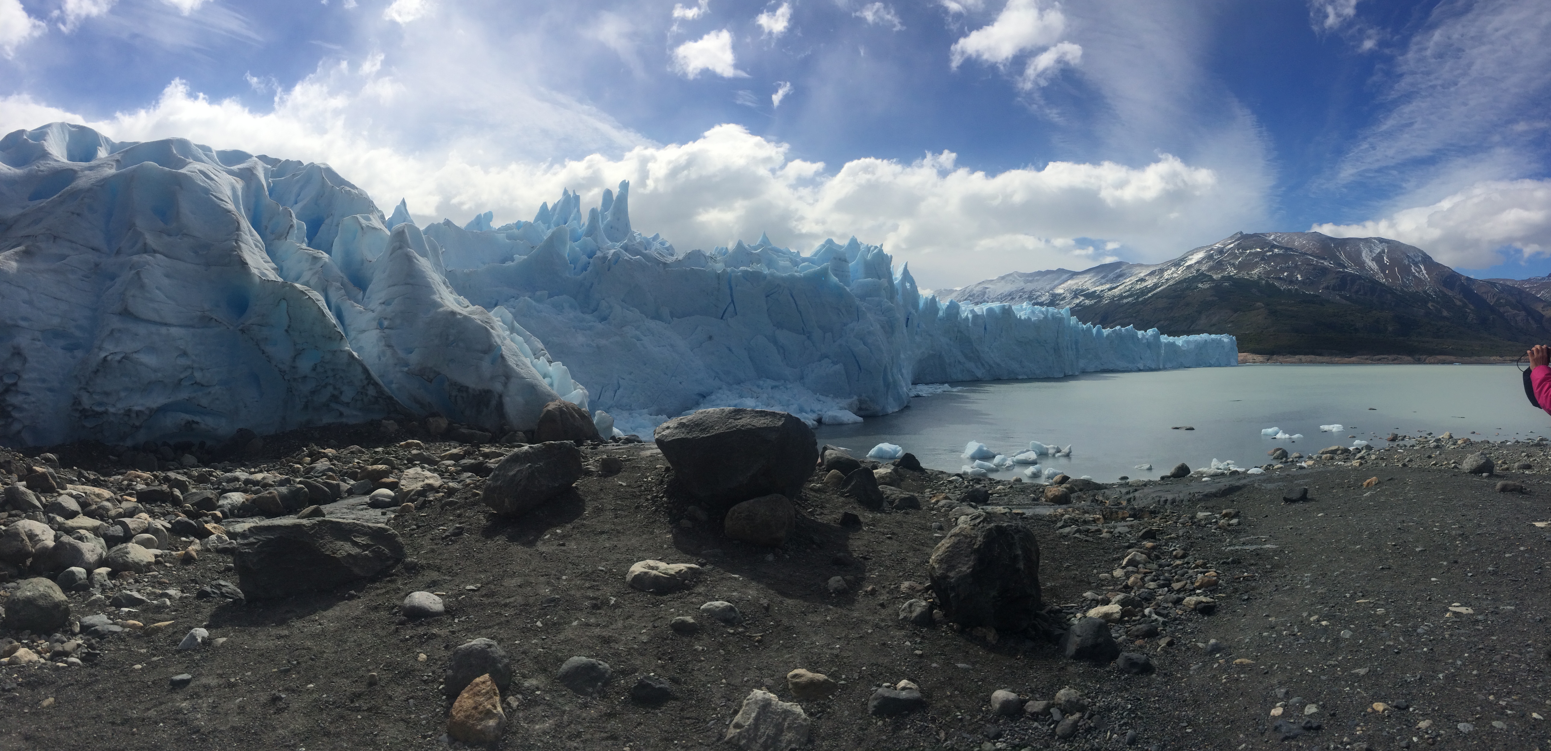
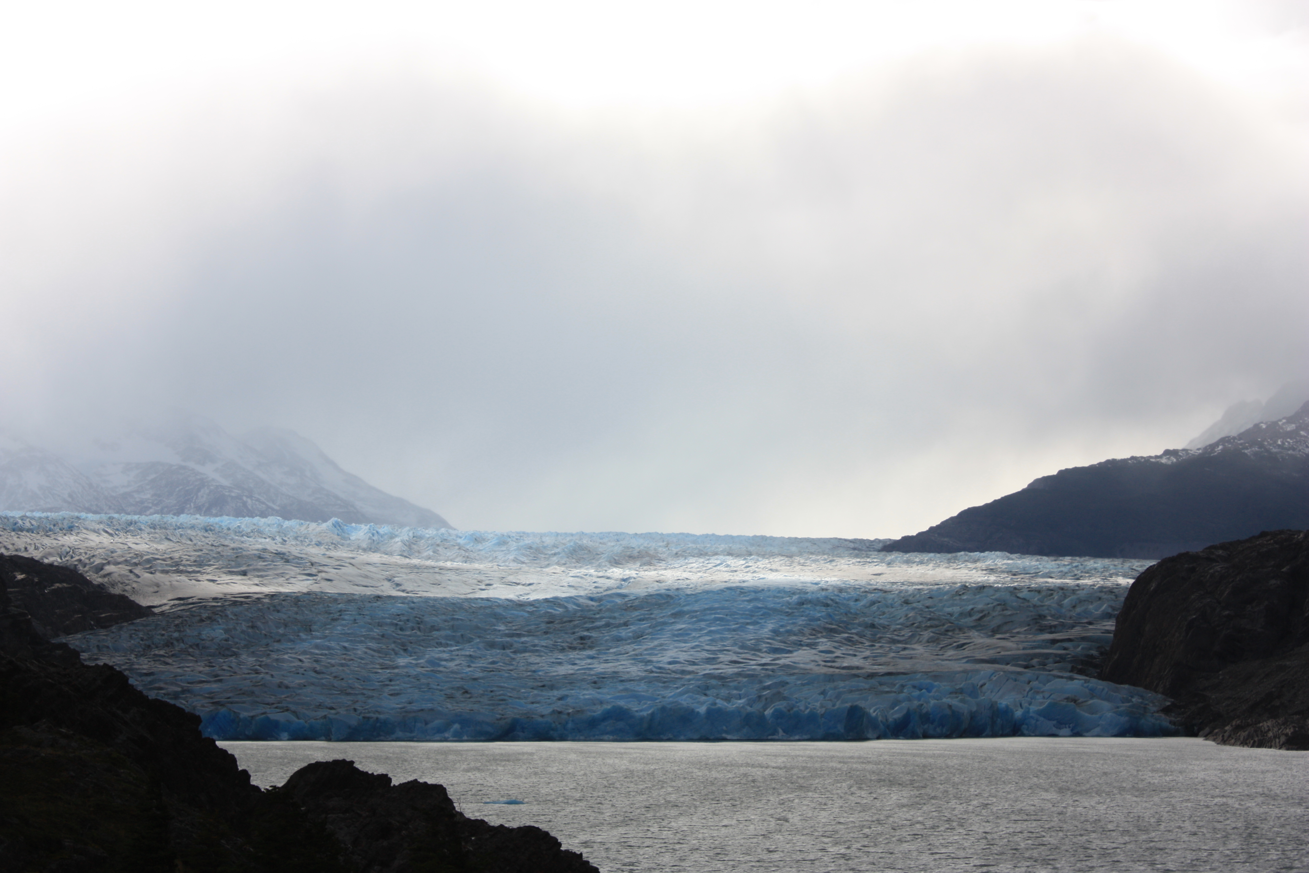
The trail climbed steadily from Paine Grande through a valley and up to Lago Grey. From there it is was up and down for a while until the first mirador from which you can see Glacier Grey. At this point the wind was insane, you could lean into the wind and it was strong enough to hold you up and keep you from falling down. After the mirador it was a steady decent with some ups and downs for about an hour all the way to Refugio y Campamento Grey. We pushed on another 15mins to the next mirador which gives you a nice frontal view of the glacier. About another hour on you can climb to a lookout above the glacier but we didn’t have enough time to make it.

On the way back the weather was clearing but the wind was still constant and although it was now behind us the strong gusts often pushed us forward and it was easy to lose your footing on the loose rocks. We pushed back to camp pretty hard and made the return journey in about five hours. Despite the poor weather it was a nice walk with views of the glacier, snow capped mountains, lakes and icebergs.

That evening the wind picked up to about 90km/h and was constantly battering the tent. At times we weren’t sure if the tent would hold but after a couple of hours the tent was still firmly in place so I finally managed to drift off to sleep. In the morning we awoke and the tent was still in tact however a packet of chocolate biscuits that I had bought from the Refugio and left sitting on top of my back in the front section of the tent had been completely eaten, every last crumb, by mice. Fortunately the mice didn’t chew through my tent like they did to the couple in the next tent over.

Day Two – Paine Grande to Cuernos

After a crazy night in the tent with little sleep we were on our way by about 9am. The wind had died down but the clouds had set in and so to had the rain. Our first stop would be Campamento Italiano, it was an easy hike there, almost totally flat, we just had to put up with the wind and the endless drizzle. The trail essentially went around the lake although only sometimes did we cross close to, or on the shore.

After about two hours of walking we arrived at Italiano very wet and cold. From here the intention was to head up the middle of the W, the French valley, however the clouds were set in low and we heard that the rivers were rising and were difficult to cross and that the ranger would be closing the trail in a couple of hours so we weren’t able to complete that section. We stopped for some lunch and then pushed on towards Refugio y Campamento Cuernos.IMG_5987

It took anther two hours to reach Curenos along another fairly flat trail. This section was now quite muddy and boggy given the rain and the creeks had begun to swell so crossing them left us with very wet boots. The final crossing was however the worst and it took us about 15 mins of walking up and down the bank to find a safe place to cross. At the point we choose to cross we had to throw our bags across and then jump from a boulder across to the other side. This was all a bit of fun and despite being totally soaked and cold we ended the day of walking on a bit of a high.

After we set up the camp were were able to rest inside the warm refugio and dry out our boots and wet clothes in front of the furnace. Our sleep was much better than the night before and although we could hear the strong winds howling above, the tent was only occasionally hit by gusts of wind. A Dutch group weren’t so lucky and their camping spot was not protected from the wind and they spent the night holding their tent in place and ended up with three bent tent poles.

Day 3 – Cuernos to Campamento Torres

IMG_6030

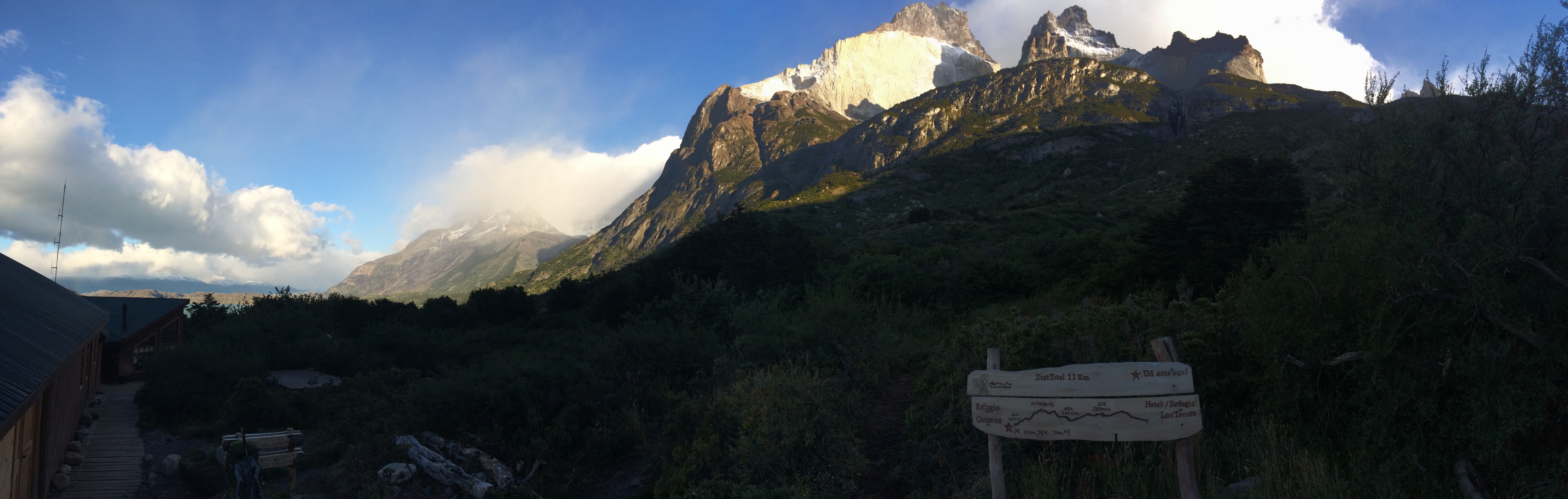
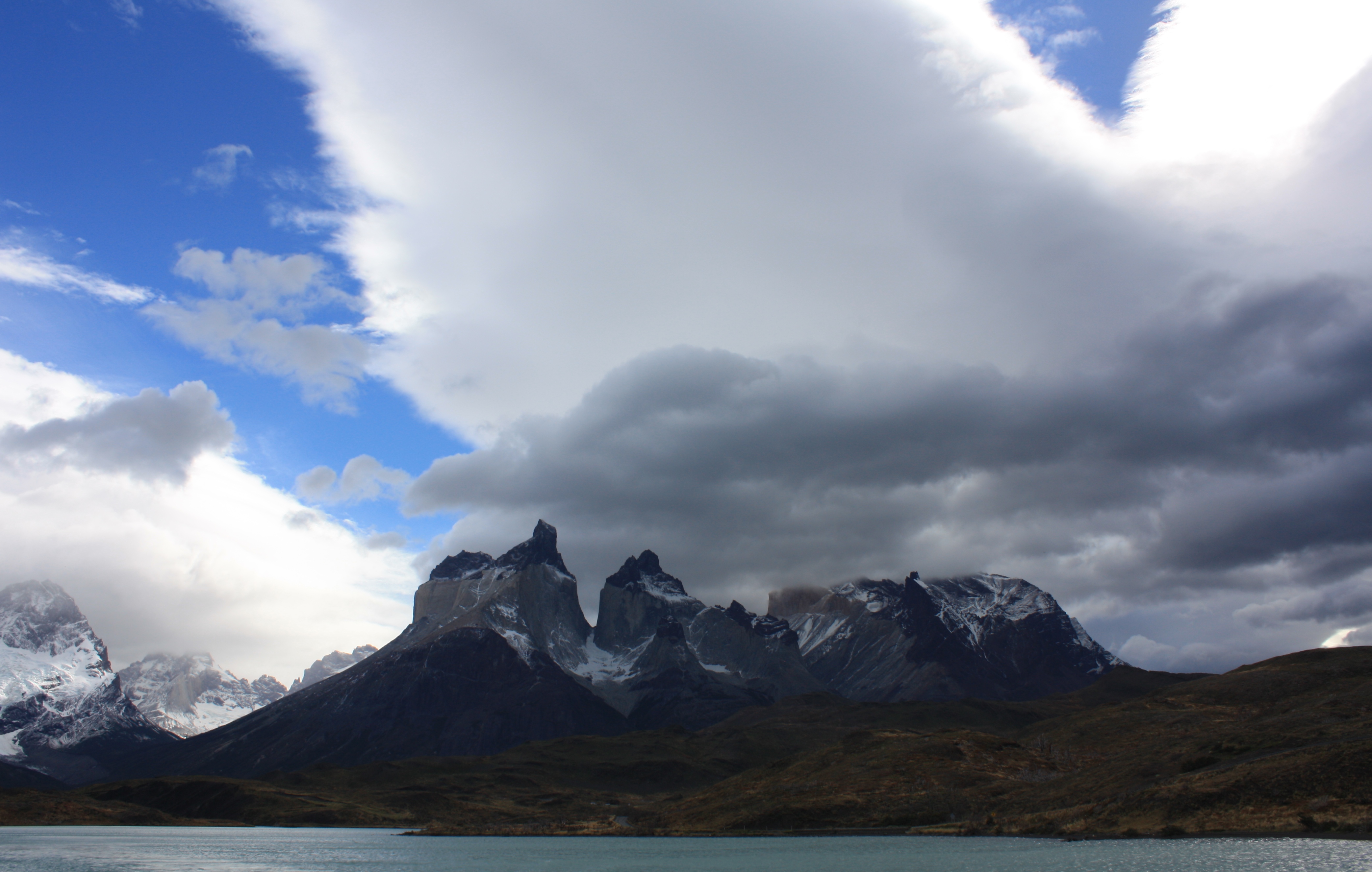
We awoke in the morning to a clear sky with the local peaks clearly visible above the refugio. The weather was a welcome change from the previous day and after some breakfast we were on our way again by about 9am.

It was a fairly flat trail that continued to follow the lake until the turnoff to Refugio Chileano where the trail headed up the valley and the main ascent started. The trail then climbed almost all the way to Chileano before it flattened out again. The views across the lake and then up and down the valley on the ascent up were great and the weather continued to be sunny and clear with little wind.

IMG_6038After Refugio y Campamento Chileano (which had already closed for the season) the trail was fairly flat for around 15 minutes and then headed up for about 30 minutes to Campamento Torres. We stopped in at Campamento Torres to drop our bags off as this is where we would camp for the night. After a short break we continued the climb up to the mirador.

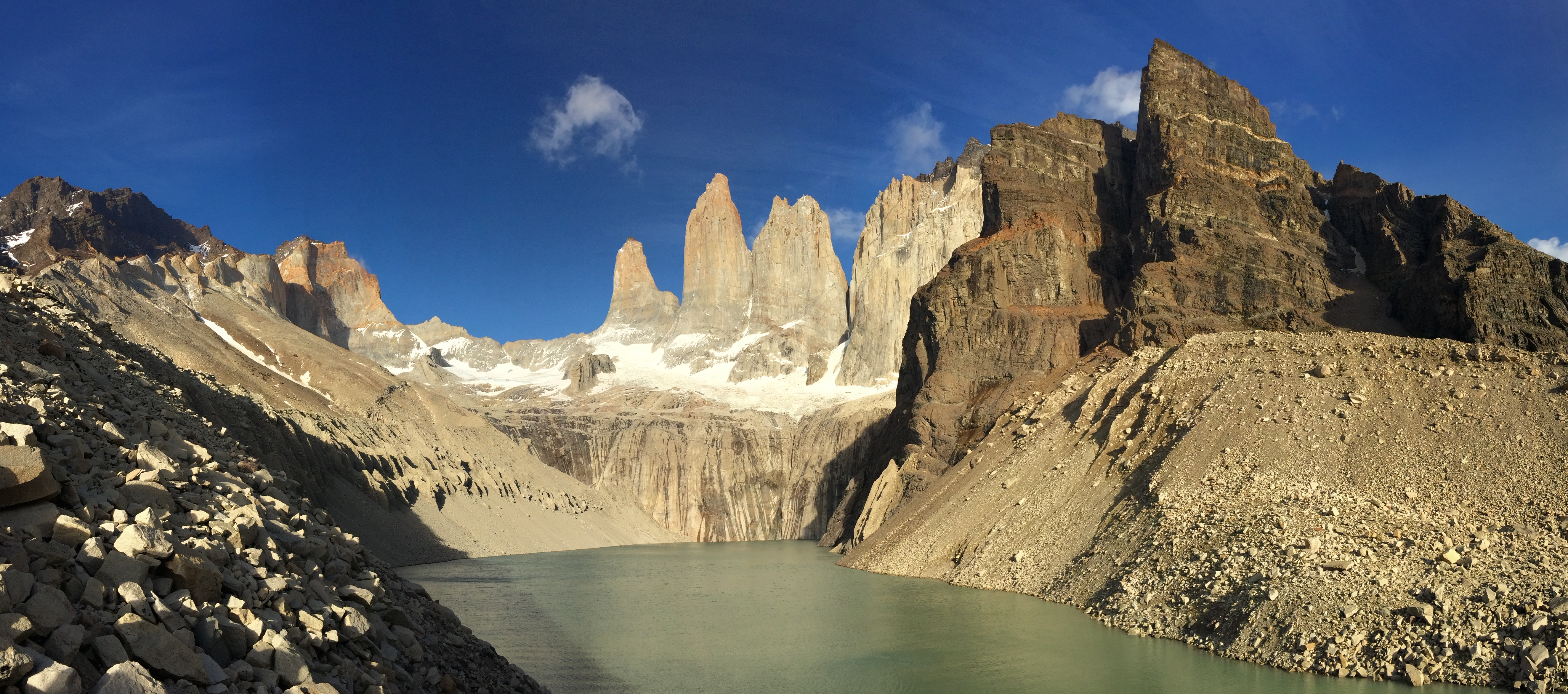
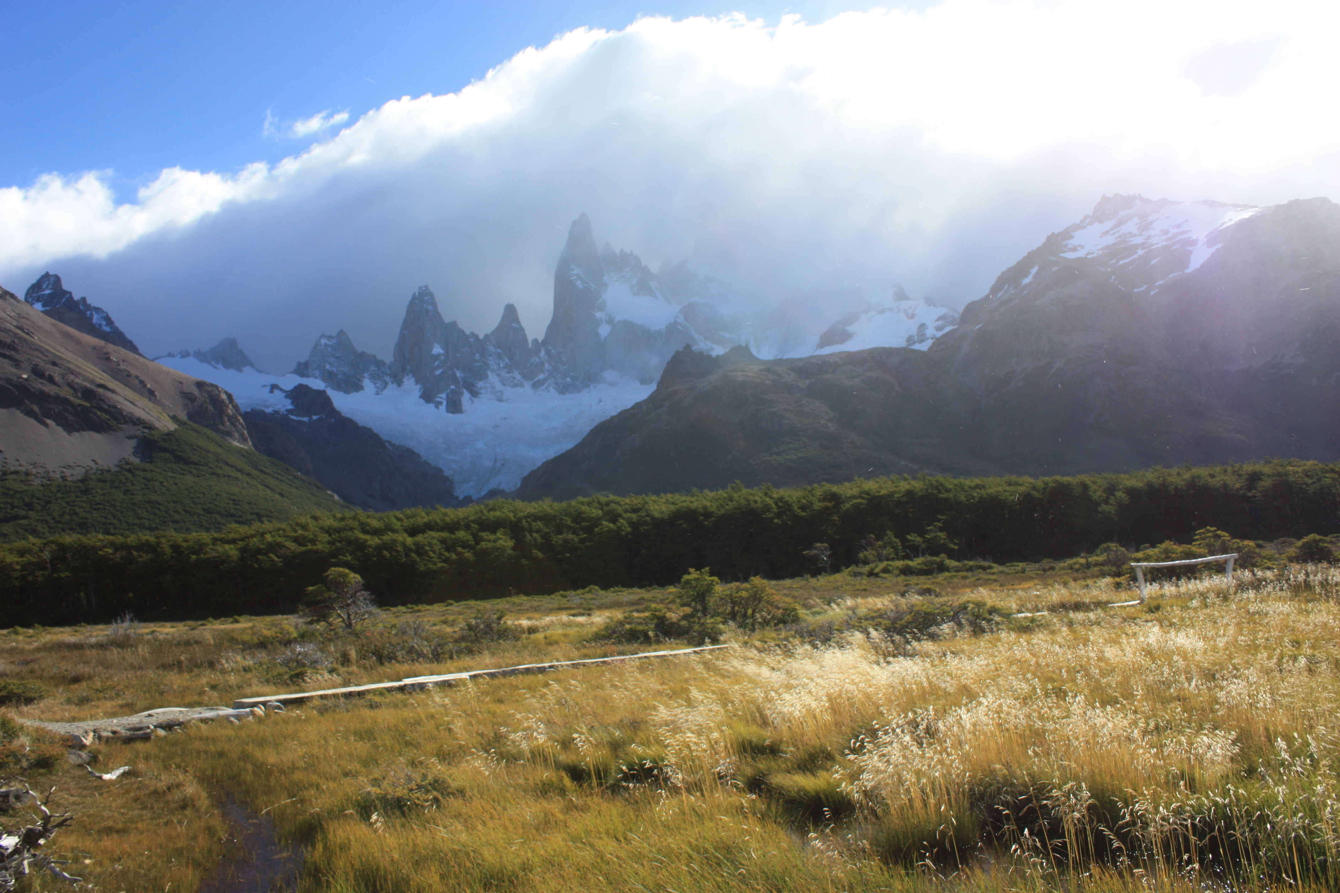
This final section of the trail, from Campamento Torres all the way to Mirador Base del los Torres, is the steppest part of the entire W trail that we completed. It is pretty much straight up and largely through open rocky terrain. This section did get a quite windy in parts but it also offered great views.

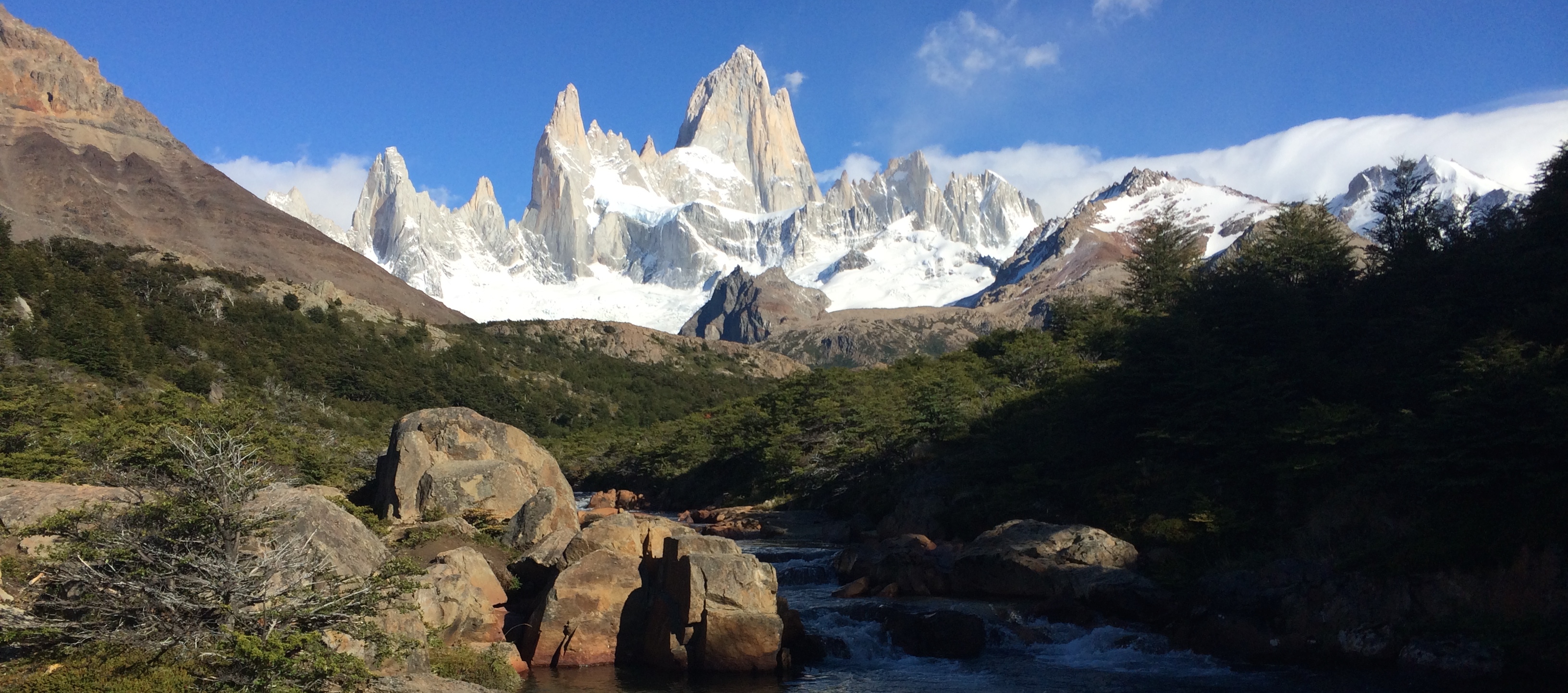
It was about a 30 – 45 minute hike to the mirador from which you are treated to a stunning view across the lake and the Torres needles. We were fortunate with the weather and the granite spires were mostly clear, there were clouds behind and at some points a light cloud would float through but the view was fantastic. While at the top we also got a very light sprinkle of snow. After taking in the view for some time we headed back down to set up camp and cook dinner. The intention was to return for sunrise the next morning which is suppose to be unmissable.

Day 4 – Torres to Puerto Natales

IMG_6060

We woke just before 7am to get ready to head up for the sunrise. The sky looked clear and I could see stars still out so it was a good sign. We got into our trekking gear and packed some breakfast and warm clothes into our backpacks and headed up the trail. It took thirty minutes to get to the top and there were no clouds insight. We found a nice sheltered spot behind some rocks and waited patiently for the first rays of sun to hit the top of the peaks. We waited for this to happen for some time but those orange, yellow and golden rays that we had been promised never came… Although our view of the sky was clear to the west, in the east there were clouds blocking the direct sunlight so although we had a beautiful blue sky behind the mountains we didn’t get the sunrise we had hoped for. Despite this the view was fantastic and even better than the day before, we stayed up the top for breakfast and ended up spending two and half hours taking in the surrounds.

IMG_6071After taking countless photos we headed back down to camp, packed up and headed out. It was then an easy hike, mostly down, all the way to Hotel Las Torres which took us about two hours. It was then an easy connection from there on a mini bus back to ranger station at Laguna Amarga where we shared a celebratory beer with the some friends we had made along the way. It was then back onto the bus at 2:30pm for the ride back to Puerto Natales.

That evening the four of us met again at Pizzeria Mesita Grande for delicious pizza and beer. The next day I would then travel by the Navimag ferry to Puerto Montt.

More Photos

Ushuia

IMG_5834

IMG_5835Ushuaia, the end of the world as it is commonly known is the most southernly city in the world located at the very bottom of the South American continent. Expeditions for Antarctica set off from here, there is plenty of trekking and it is possible (in the right season) to visit colonies of thousands of penguins. The environment here can be very harsh with strong cold winds coming up from Antarctica, even in summer the surrounding mountains are covered in snow.

IMG_4389The weather outlook for my stay wasn’t very promising so I was only in town for two full days during which I explored the town, hiked up to Martial Glacier and spent a day walking in Tierra del Fuego National Park.

The Martial Glacier is directly behind the town and although the glacier itself isn’t that impressive the view from it is. From the top of the hike you can see down onto Ushuaia, the surrounding mountains and out to the Beagle Channel and onto Isla Navarino, Chile. The trail takes you from the bottom of the winter ski slope up into the mountain, the gravel then gives way to snow and the hike can be a little wet and slippery. Sections are fairly steep but after an hour or two you are at the top and you just can’t beat the view. Heading down can also be a little challenging until you get out of the snow and then if you decide to walk all the way back to town there are some nice trails through the bushland that you can follow rather than walk down the road.

IMG_4459To explore Tierra del Fuego national park you need at least a whole day, with two you could climb Cerro Guanaco. I just started from Ensenada Bay where I first walked the 3km Alta Plata trail which took about an hour and a half return up to the lookout. If you don’t have much time then you could probably give this one a miss as the views weren’t that impressive. I then followed the Coastal trail which follows the shoreline along Ensenada Bay. This was very nice walk, it is very easy and you get to see a number of different bird species. The view across the bay and onto the surrounding snowcapped mountains in both Argentaina and Chile is stunning. Apart from the birds I also saw two foxes at the end of the trail that both just casually strolled past me.

The following morning I was on the early bus (5am) to Punta Araenas in Chile. The bus ride was suppose to take around 12 hours as it included a border crossing and gravel roads however it turned out to be much much longer. Not long after lunch we made it to the Straight of Magellan which separates Isla Grande de Tierra del Fuego and the South American mainland, here there is no bridge but a ferry to take you across however due to the 100km per hour winds the ferry was not running. After six hours of waiting we were finally able to make the short crossing and then it was another few hours to Punta Araenas. Originally I planned to visit a penguin and sea lion colney the next morning but due to our late arrival this wasn’t possible and I headed straight onto Puerto Natales to get ready to start the W trek in Torres del Paine National Park.

More Photos

El Chalten

IMG_5687

El Chalten is a beautiful town set within a valley in the Los Glaciares National Park. The surrounding views, even from the town on the valley floor are stunning with the granite peaks of Mt Fitzroy and Cerro dominating the landscape. Access to El Chalten is usually via El Calafate which is an easy three hour bus ride away. If you come by one of the many buses that arrive during the day you’ll stop at the ranger station on the edge of the town where you will receive a run down on the national park. The rangers are very passionate about the area and their primary goal is to keep the park in a pristine condition for the generations to come, and keep it free, so they really drill down the point of respecting the land and that you leave no trace when hiking and camping in the national park.

The weather in this town, and the whole Southern Patagonian region is very unpredictable and in summer there can be very strong winds so it is ideal to allow extra days in your itinerary to wait out the weather if required. I spent six days here which wasn’t long enough if you really enjoy trekking and camping, but it was ample time to complete three amazing short treks.

Lago de los Tres – Mt Fitz Roy

IMG_4133After arriving from El Calafate in the morning we got some supplies together and headed out around 3pm for the camping ground. Our intention was to hike up to the campsite, stay the night and then hike up to the lake to see the sunrise which is suppose to be quite amazing when the first rays of light hit the granite peaks.

IMG_4137The weather when we left El Calafate that morning was quite average but it cleared up throughout the day and when we started our trek most of the sky was clear, just not the section over Mt Fitz Roy… The trail head is at the western end of town and from here the track steadily climbs for about an hour before flattening out. As you climb there are some views back over El Chalten from behind and some great views further down the valley and onto the snowcapped mountains. After the climb and once through a forested area the view is now directly onto Mt Fitz Roy and its neighbouring mountains and glaciers.

IMG_4155The hike to the Camp Poincenot was generally pretty easy. The camp is not particually pretty, it’s sheltered among tall pines that provide some protection from the gale force winds but offer no view. After setting up camp we still had a few hours of daylight left so we decided to head up to the lake so we would know what we were in for the next morning.

After perhaps 20 minutes of fairly flat terrain the trail then climbs steeply to the lake for about an hour. It was a very windy and at times the wind was almost strong enough to knock you down if you didn’t have firm footing. At the top, if it was clear, the view of the glacier and the peaks would be amazing but we were only able to see glimpses peaking through the clouds. It had now started to rain/sleet which felt like needles against our skin given the incredibly strong winds. We took in the scenery as quick as we could and then headed back down to camp.
Over night the wind died down but by around 5am it was stronger than the day before so we decided not to head up to the lake for sunrise. I checked for clouds again at 7:30 when there was some light and the peaks were still shrouded by clouds so we were glad we didn’t battle the winds for nothing. We started to head back around 9am and to our surprise when we looked back after leaving the camp the sky had completely cleared and the view of Mt Fitz Roy was stunning. We stopped not long after in a sunny spot near a stream for breakfast where we could take in the view.

Overall the trail is quite moderate with the exception of the final climb to lake and with clear skies the scenery is exceptional. It would be a solid day hike up to the lake and back of about 8 hours.

Lago Torre

Screen Shot 2014-05-01 at 12.45.07 pm

IMG_4226This trail starts at the northern end of town and steadily climbs for around an hour. As you head up there are view back towards El Chatlen but from a different aspect than from the Mt Fitz Roy trek. When the trail starts to flatten out at Mirador del Torre you are greeted by the first complete view of the tall granite spire of Cerro Torre. The trail then heads down for a short while before a steady climb all the way to the camp and Laguna Torre. The views along the way are great but the view from the lake is fantastic.

From the lake you can see Cerro Torre in all its glory along with the glacier which snakes down in front of the mountain through the valley and breaks out into the lake. When we arrived at the lake we were treated to the view of a fairly large iceberg that had run aground not far from the shore. After some lunch we headed up around the northern side of the lake from where there are great views down onto the glacier, Laguna Torre and of course Cerro Torre.

This was a great day trek and was fairly easy going the whole way but allow for an 8 hour return journey.

IMG_5726

Lago Torro Trek

Screen Shot 2014-05-01 at 12.46.17 pm

IMG_5761After awful weather the day before the wind had died down and the sun was shinning for the start of my trek out to Lago Torro which would be a two day trip there and back. The trail head starts at the eastern end of town behind the ranger station, two short walks also start from the same location but head east while this trail heads south. It’s approximately 15km each way and the suggested time is 7hrs one way although at an average pace and carrying food and camping gear I made it in about 4 and a half hours to the campsite with good weather.

The trail starts off in nice country, heading up out of the valley that encompasses the town. From here it is a steady ascent for some time and you are treated to great views back over El Chalten and onto Mt Fitz Roy, Cerro Torre and the other peaks that stand tall over the town. After an hour or two you come to a fork in the road, to the west is the trail to mirador Pliegue Tumbado and the trail to Lago Torro continues south.

IMG_4258The trail now heads into a forested section and when you finally exit the forest you are faced with a great view of a snow capped peak straight ahead, to the west Mt Fitz Roy and two the east a small lake and beyond that is Lago Viedma. You then enter another small forest and when you come out from here the views are even better.

The trail continues along the top of this hill for some time before decending down to the valley floor below. This section was quite windy and it didn’t abate until I was well and truely down into the valley. The next section seems long and a bit boring. There are a couple of streams to cross and after another  hour or so is the Lago Torro camp ground. The camp ground is behind a rocky outcrop and a forested area partially protecting it from the winds that batter the valley.

Just around from the camp is Lago Torro and behind the lake lies the glacier Rio Tunel. If you have at least another three hours of light you can climb up the mountains behind the lake up to the face of the glacier. For me this was the highlight of this trek and was what made it worthwhile. The views from above the lake are very impressive to say the least. It is possible, with care, to get within a few meters of the glacier, standing safely on the rocks on the other side of the face. Its also possible to scale this hill for 360 degree views over the glacier, the valley and lake from where you’ve just come. Caution needs to be taken with this climb up and even more going down as there is no trail and you just have to find your own way. It is easy to get stuck on a ledge with no way down.

From here it is possible to cross the pass beyond the glacier and loop around back past the lakes for a 3 or 4 day circuit. I wasn’t aware of this when in set out so on the second day I headed back the same way I came.

If you have at least two days available to complete this trail I highly recommend it if you are up for climbing up to the glacier.

After El Chalten it was onto Ushuia at the bottom of the South American continent.

IMG_5778

More Photos

El Calafate

IMG_4074

IMG_4020El Calafate is a popular tourist town in southern Argentina, it is part of the Patagonian region and is the gateway to Perito Moreno Glacier, Los Glaciares National Park, and stunning trekking in El Chalten. There are buses and flights to El Calafate from as far north as Buenos Aires, in the south from Ushuaia and also buses from Torres del Paine in Chile. A trip out to Perito Moreno Glacier is a must which can be done on a tour or simply by catching the bus out for a few hours.

Perito Moreno Glacier is one of only a few patagonian glaciers that are still advancing. This glacier is in a constant state of movement which gives its visitors a spectacular show every single day when sections, sometimes quite large sections, break-off and crash into the water below. On occasion the glacier has been know to make landfall and dam the water on the western side of the glacier which then builds ups and eventually creates a land-bridge and then that bridge eventually collapses.

The shape of the valley and the general area make access and viewing of this glacier very easy, there is a road right up to its face. A substantial boardwalk has been constructed along the shore opposite the face of the glacier which gives you a front row seat to all the action but at a safe distance. If the boardwalk isn’t enough then you can head out onto the ice on a tour with Hielo & Aventura. We did the Mini Ice option which was OK but I wouldn’t really recommend it, the Big Ice option would be much better as you get to spend a lot more time on the ice and see a more remote area. Other companies also offer similar trips in the El Chalten region and they also include ice climbing.

The only thing to see in El Calafate is the glacier so the following day we caught one of the many daily buses to El Chalten, 3 hours away.


More Photos here.

Bariloche

IMG_5580

Bariloche is a beautiful small town in Argentina which lies on the eastern side of the Andes. In winter it a very popular ski town and in the summer it is great for trekking and rock climbing. Bariloche and the surrounding area is in one of the northern sections of the Patagonia region which extends north to Concepcion, Chile, and south to the bottom of the continent, encompassing parts of both Argentina and Chile. The town itself is stunning and sits on the edge of Lago Nahuel Huapi with views onto the Andes and has streets full of chocolate and ice-cream stores. While here apart from exploring the town and trying the local chocolate we competed a one day trek to Refugio Frey.

Screen Shot 2014-04-05 at 8.59.26 am

To get to the trailhead from Bariloche it is a short 30 min bus ride out to the Catedral Ski park. There are maps available from the information desk near the carpark but they really only show the ski runs which in summer are pretty much worthless. The trail is however very well marked and a map is not necessary. From the left side of the carpark (when facing the mountain) the trail heads up and around the mountain heading away from the winter ski area. It continues south around the mountain giving some nice views back towards some nearby lakes. After about an hour the trail heads west up into the mountain through a forested region before finally breaking out into a rocky and dry valley. Despite the lack of vegetation in this area there is a solid river running through the valley that is fed by a couple of alpine lakes, one of which is at Refugio Frey.

IMG_3928The hike up to Refugio Frey on this trail was quite easy and the views across the lake and the rocky outcrop above are stunning. From Refugio Frey many climbers also set out for what looks like a pretty amazing climb up a sheer rock face above the lake. For the return journey we had the option of returning the way we came or continuing north-west past the lake and then up out of the valley. We chose to continue on and we were rewarded with great views the whole way. This section of the trail was a bit more challenging than the way up and included a bit of scrambling. It takes maybe an hour to get up to the second lake and then another 45 mins to get up over the pass to the other side of the mountain. Once over the pass you are welcomed to views out to some snow capped mountains and a green valley below. The trail then cuts across lose rock for almost two hours until you reach the top of the ski park. It is then possible to head down to a ski lift on the right for a cable car ride down to the car park. By this stage a free ride was most welcome as the second part of the hike was quite tiring. The walk down from the top of the ski park would likely take another two hours, fortunately we made it to the ski lifts just before they shut them off at about 5pm (in summer there are two lifts running for hikers). Once on the lift the workers jumped on behind us and we were the last passengers for the day.

IMG_5585

Completing the hike as a circuit, and in the direction we did, was in hindsight a good choice as the views you get are completely different and the return journey was much more dramatic. If you intend to do this trek make sure you allow about 8 hours and leave early enough so that you can make it to the last ski lift at around 5pm to avoid a long walk down the dry slopes.

From Bariloche we did a marathon 30hr bus ride to El Calafate.

More photos here.

Vietnam

IMG_3686Vietnam is a mash of developing modern cities, rural countryside villages, beaches and islands getaways. The country is prospering like never before, finally at peace, after a long history of war. They warred with the Chinese for 1000 years, were under French rule for 100 years, Japanese occupation in the 1940’s, U.S influence and war from 1954 to 1975, the transition to communism cost many lives and finally they defeated the Khmer Rouge rule in Cambodia in 1978 whom had been attacking border villages. Despite this history of war the people of Vietnam were welcoming, kind and always helpful. Since 2000, the country has undergone unprecedented economic growth and is quickly joining the rest of the developed world although there is a large disparity between the rich and the poor.

In February 2014 Sam and I spent a mere five days in the country visiting just Ho Chi Minh City, formally Saigon, and Hoi An. It was a just enough time to get a small taste of what the country has to offer but four weeks or more would be ideal to really explore this beautiful place.


Batase Village Jan 2014

IMG_4953

It was only a short visit to Batase this time round, largely just to visit the children at the hostel and all the students at the school. Sam and I caught the public bus from Boudha to Talamarang which took about four and a half hours. After our lunch of veg chow mien we discussed whether or not to wait for the bus up to Batase… Read more here

My new and revised blog

I have recently redone my old blog and it can now be found here. I am about to set off again after two years back at home, it has been a great two years home with friends and family but it is now time to set off again. After a few weeks in Nepal and Vietnam I will be heading to South America for a few months to learn Spanish, trek Patagonia and get my CELTA qualification before moving to Nepal to work with the Friends of Himalayan Children in Batase Village where I spent some time two years ago.

On my last trip I travelled through Cambodia, Laos, China, Tibet and Nepal. I also spent time in London and volunteering at Nalanda Monastery in France.

I have now updated this blog to include some photos from places I have visited in Papua New Guinea, New Zealand and here in Australia.

I’ll continue to keep this up to date as I travel through South America and back to Nepal.

Mount Tibrogargan

Quick climb up Mt. Tibrogargan this morning…

Great track!

Lots of scrambling – a little climbing. Great views on the way up and from the top. The trail is marked up until the bottom of the summit trail then it easy enough to find your way up the rocky climb. Click on the picture below to see the trail on Wikiloc.

Screen Shot 2013-12-23 at 1.20.27 PM